If someone spends enough time in a foreign or even hostile place, he or she will put down roots of sorts. Napier is no longer foreign nor was it ever hostile, not to this writer. But I've not put down much in the way of roots. I've acquired routines and in that way I've domesticated my time in New Zealand. But I've not become a part of the Napier community. This is in marked contrast to the previous stay in New Zealand, from January into July 2013, when Jean and I lived in Te Awamutu (TA).
There we actively participated in St John's Anglican Church, which (among other things) became an important channel for becoming rooted in TA. I suggested in an earlier blogpost (13.09) that a measure of love is behind every form of knowledge and even more so behind anything having meaning for us, even mere words. Without commitment and engagement, there can be no knowledge, no meaning. The less the level of commitment, the less the knowledge or meaning to be found... or lost.
All of which said serves as a preface to my observing that while I don't look forward to pulling up stakes in Napier, the departure from Napier will have less meaning and emotive weight than did our departure from Te Awamutu. There simply hasn't been the community engagement here that I was able to have in 2013. If Jean and I had arrived after the end of the New Zealand summer vacation season, as we did in TA, there would have been more opportunities to become engaged in community efforts and organizations, which become quiescent during the summer vacation season (December thru January).
So it goes or so it has gone. Our 'domestication' in the Ahuriri district of Napier will come to an end in a few weeks. In a previous blogpost (13.10) I discussed the housing preferences of Kiwis. In this one I've included photos of Kiwi housing stock. For starters I've included photos of the Ahuriri complex where we were assigned an apartment. The apartment complex in the Internationalist style is quite at odds with prevailing Kiwi tastes and preferences, at least beyond Auckland and Wellington. While our Ahuriri apartment lacked charm, it offered a superb view of Ahuriri Harbour. I'll give it that. Beyond the Internationalism of our Ahuriri digs, you'll find images that will hopefully convey the winsome structures where most Kiwis make their homes.
Warm regards,
Tim (& Jean)
PS I've also included some photos of an old Raglan hotel, like other Victorian or Edwardian-era hotels I've seen in New Zealand. There are also some photos of a Kihikihi primary school, very typical of schools throughout New Zealand in being of wooden (earthquake-sturdy) construction. Hotels and schools, after all, are homes away from home.
5.B 14 West Quay (on Left), Pohutakawa in Bloom, Bluewater Hotel (on Right)
A friend recently asked for a perspective on New Zealand's railways. In 2013 I published a post discussing New Zealand's rail passenger transport and recently I published a post discussing the country's maritime ports. I'll take the liberty here of providing a perspective less close to the ground, at least less close than those preceding posts. I'd like to take a more expansive look at New Zealand's transport infrastructure. The railways are only one piece of the transportation puzzle and transportation is but a piece of a larger picture that embraces New Zealand's culture, population, and economy.
Who fifty years ago would have imagined New Zealand to become what it has become now? It's an agricultural powerhouse, moreover one whose power isn't dependent on any role it plays within the British Commonwealth. Its leading trade partner is no longer the United Kingdom but rather China, with Australia in close second place. Its people now comprise not only the core Māori and Europeans who formed the nation in 1840 but also substantial numbers of recent immigrants: Indians, Pakistani, Chinese, Southeast Asians, and peoples from the South Pacific islands.
The cross-strait ferry services between the North Island and South Island first began only a little over fifty years ago (in 1962), between Wellington and Picton. Before 1962 ferries connecting North and South operated between Wellington and Lyttleton (Christchurch's port town). By the mid 1970s the Wellington/Lyttleton services had disappeared and the Wellington/Picton ferry service had become the vital link that supports the nation's railway and highway network.
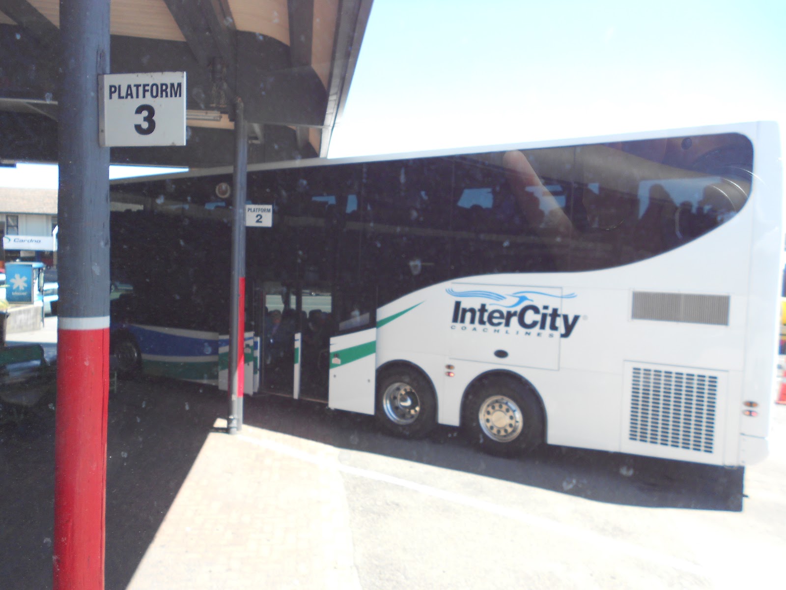
In the last fifty years New Zealand's intercity rail passenger services have largely disappeared. On the other hand, in just the last ten years metropolitan rail passenger service has blossomed in Auckland and continues in Wellington, growing fivefold in New Zealand's prime city. Commercial aviation has become the predominant form of domestic commercial passenger transport with bus lines offering excellent cross-country and tour services. Auckland Airport has become the country's major international passenger port. And totally unforeseen fifty years ago, Tauranga has become New Zealand's premier international maritime port (See Blogpost 15.01).
Today according to the Road Transport Forum website around 92% of all freight within New Zealand is conveyed at some point by road, albeit perhaps about 20% of freight ton kilometers are accounted for by rail (according to Transportation Engineering Research New Zealand). Highway freight transport is overwhelmingly predominant in New Zealand in a way it wasn't, say, fifty-some years ago. In the USA, in contrast, rail ton miles (as reported by various parties) constitute a significantly higher portion of freight transport (usually around 38%) than in New Zealand; by all reports the rail portion of US freight ton miles is growing.
Despite the importance of highways in New Zealand, only about 2% of the state highway network (the country's main trunk highways) comprises limited-access multi-lane highways. Moreover, the state highway network has numerous narrow bridges, one-way bridges, even one-way tunnels, and so on and so forth. Highways and roads off the state network are plagued with narrow lanes, narrow shoulders, one-way bridges, sharp curves, etc. The most cursory glance at a New Zealand highway map will hint at the sinuosity of the vast majority of New Zealand's highways. Given the importance of roads in New Zealand's transportation universe, why is there such a 'deficiency of roadway capacity', if I may put it that way?
I think the answer has two parts: topography and wealth. And to get at those parts, I'll briefly compare New Zealand with the US state of Colorado. New Zealand (268,000 sq km) and Colorado (269,800 sq km) have about the same amount of territory. In 2014 the estimated population of New Zealand was 4.5 million and of Colorado 5.4 million. All other things being equal here, population size differences can serve as a surrogate for differences in overall wealth (I don't have comparable gross domestic product data for New Zealand and Colorado). Colorado by population count is wealthier. Moreover, Colorado isn't as mountainous as New Zealand. The eastern half of Colorado is high plain. But there are few large relatively level areas in New Zealand: the Waikato in the North Island and the Canterbury and the Mackenzie in the South Island. Moreover, though I can't prove this (I couldn't obtain comparable data), I suspect the public roadway (highway, road, and street) kilometers or miles in New Zealand exceed Colorado's public roadway miles. New Zealand has numerous, dispersed (if often tiny) settlements connected by public roadways. In short New Zealand has relatively more topographical challenges to its roadway network and probably more 'service points', if you will, but less wealth to overcome those challenges.
All things considered, I find it remarkable that New Zealand's highways are as good as they are. As I've said in other posts, generally foreign visitors (especially those not accustomed to left-hand driving) would be well advised to use commercial transport (air, bus, or rail) for cross-country travel in New Zealand, rather than to undertake the arduous task of driving cross country.
Looking into the future I'll venture the following speculations vis-à-vis transportation. Please indulge this hobby of mine; among other things these speculations are a way of attaining some perspective on current conditions.
As forairway travelin New Zealand...
Domestic commercial air travel (within 5 years) is likely to be saddled with the security procedures that bedevil air travelers in much of the rest of the world. Sic transit gloria, I say with a sigh.
Wellington Airport will solidify its role as a domestic air hub thru incremental improvements on its constrained site but also by extending its runway (within twenty-five years), thereby enabling more international flights.
Auckland Airport will maintain its predominance, enhancing its facilities and improving ground access by enabling construction of a railway extension into the airport (within twenty-five years).
As for highway travel & transport in New Zealand...
A limited access highway will connect Auckland and Wellington (within twenty-five years) with a spur to Tauranga (within thirty-five years) and perhaps another spur to Rotorua (within fifty years).
Intermittent limited access highways will exist on State Route 1 on the South Island between Picton and Dunedin (within fifty years).
A second, tunnel crossing of Waitemata Harbour (in Auckland) will be constructed (within fifty years).
As for maritime transport within twenty-five years...
Tauranga will overtake Auckland as the prime import port and will maintain its role as New Zealand's prime export port.
Marsden Point, now supported by Northland Region interests as an alternative international container port to Auckland, is unlikely to materialize because of its far north location, its inability to offer outbound container traffic (to balance inbound loads), and the inability to complete a rail line connecting Marsden Point*** with the national rail network (not to enumerate other shortcomings).
Major international container services will restrict their calls to no more than three New Zealand ports (Tauranga, Lyttleton [Christchurch], and Napier) with other container ports having subsidiary roles.
As for railway transport within twenty-five years...
Palmerston North and Hamilton will become inland container hubs (or ports) and even seaside cities, like Auckland and Dunedin, will become container hubs on the freight rail network.
There will be so-called 'shortline' freight operators, independent of KiwiRail (or its successor), operating lines that otherwise would be abandoned. The Napier-to-Gisborne line comes to mind*/**.
Intercity passenger services, if they exist at all, will be run by tour operators (For an account of KiwiRail passenger services circa 2013, see Blogpost 13.23).
Metropolitan (or commuter) rail service will expand in Auckland, including the completion of the Auckland City Rail Link (See here), construction of an airport extension, and extension of service to Hamilton if the North Island Main Trunk ('NIMT') railway is electrified between Hamilton (Te Rapa) and metro Auckland (Papakura).
As for the Cook Strait Crossing...I can't help but wonder what, if anything, will be done to 'solidify' the transport connection between the North Island and the South Island. The Cook Strait, which separates the islands, is reportedly one of the most treacherous bodies of water anywhere in the world. Were there, say, 80 million Kiwis or had New Zealand somehow 'struck gold' big time, probably a tunnel would have already been built, rendering ferry crossings unnecessary. The three-hour ferry journey can take as long as eight hours and is subject to multiple hazards. A rail tunnel built to accommodate standard gauge trains (and KiwiRail's Cape gauge trains) would, for example, enable roll-on, roll-off truck, bus, and auto services that would be unaffected by weather or tidal conditions. But building a tunnel would be quite costly, no easy task in a fault-riddled region, though the Japanese especially have a world of knowledge to bring to this kind of project. I wouldn't hazard a guess as to whether any tunnel (rail or highway) will ever be built under the Cook Strait. Because of Cook Strait winds, a bridge would be insane. But so long as there isn't a tunnel, it will always be a solution waiting for the funding to happen. Anyone out there with pots of gold?
Perhaps these prognostications have been a bit too breezy. I'm not a Kiwi, so I don't have to live with the social consequences of any slights or oversights that I've committed. Nor have I spent years studying the matters that I've touched on. I've not undergirded my prognostications with extended argument and tables and charts. In a word, my free prognostications may be worthless. I offer them nonetheless.
You can be sure there are Kiwis in government, in the business community, in the broader community, and not least in transportation, who are concerned with how New Zealand's transport infrastructure will look in, say, twenty-five or fifty years. We can also be sure that the future will be different in ways that even the best prognostications don't anticipate.
Warm regards,
Tim (& Jean) P.S. (7 February 2015) Within a few days of publishing the above post I was asked to submit an op ed piece to Urban Milwaukee, which published the piece on 5 February under the title 'A Tale of Two Cities'. It compares and contrasts urban transport policy in metro Auckland and metro Milwaukee, especially in light of proposals in both cities for the installation of tram or streetcar service. * As of 22 August 2016, Hawke's Bay Today reported that a decision was imminent on re-opening Napier to Wairoa service, perhaps a prelude to rehabilitating the Napier-Gisborne line. Later in 2016 the Napier-Gisborne Railway was incorporated and a so-called 'Napier-Gisborne Railway Shortline Establishment Group' launched a website. **As of 12 July 2017, The New Zealand Herald reported that the Maori Party is advocating the redevelopment of New Zealand's regional railway network and specifically advocating the restoration of rail freight service (and perhaps eventually passenger service) on the Napier-Gisborne line.
***A 20 May 2019 report in interest.co.nz portrays the continuing discussion about the estimated costs and benefits of a railway upgrade and extension into Northport (or Marsden Point). The overall picture doesn't include a 'green light' for that extension.
3.A Distance and Direction Boards at Cape Reinga Lighthouse (Showing Distances in Nautical Miles and Kilometers)
There are three kinds of points in travel, minimally conceived: origin and destination points, mere points in between, and swing or portal points (in which one's travel takes a change of direction). The direction and distance boards appearing above mostly point to origin and destination points: Sydney, London, the South Pole, etc. On the other hand, for example, the Tropic of Capricorn, circumscribing the globe at approximately23° 26′ South is a mere point (albeit a mere point with a name)for most travelers, the point where one's line of travel intersects the line of the southern tropic. The distance and direction boards gathered above attain their significance because they are placed at a swing point in maritime transits, namely at Cape Reinga at the northern tip of New Zealand. Jean, our younger daughter (Emily), and I traveled to Cape Reinga during our recent sojourn in New Zealand's Northland. We anchored our Northland visit in Paihia, as I've previously reported. To reach Cape Reinga we elected to take a tour bus. Such tour buses pick up and drop off tourists at lodgings in Paihia and Kerikeri. Our Fullers GreatSights tour bus fetched us about 7:15 on a bright, sunny morning. After gathering additional tourists at other lodgings, our bus driver headed us to Puketi Forest. That forest happens to have some rather large and old kauri trees, though not the largest in New Zealand. The kauri is the tall, broad self-delimbing tree from which the Māori could carve a waka, or war canoe (among other things). When humans first appeared in New Zealand, kauri forests covered the North Island as far south as Kawhia, southwest of Hamilton on the island's west coast (Jean and IvisitedKawhia in May 2013 and I can attest that there are now no kauri anywhere near Kawhia). Our visit to the Puketi Forest was cool, the forest's lower layers not yet warmed by the rising sun. The walkways we used had been constructed for a visit by Queen Elizabeth II. They made our exploration quite easy. But there would be no time for lingering. Because of the day's schedule, the visit was kept brief.
Following the forest visit, our charismatic bus driver and tour guide, Chris, drove us to an early (11 AM) brunch at Houhora, where everyone was served either fish and chips or a vegetarian offering. The brunch was earlier than I would have wanted, but brunch time is partly dictated by the tides on the Tasman Sea, on New Zealand's west coast. You see, one of the features of virtually all Cape Reinga tours is a run along Ninety Mile Beach (along the Tasman). The buses run north or south along the beach when the tide is low. Chris had us running north on a receding tide, which is probably the best possible situation for the buses and 4-wheel-drive vehicles allowed to run on the beach.
3.F Front of Bus No. 78
Chris kept the bus running along at speed (90 kph is the limit for buses), except when he had to cross a stream or when we got in the vicinity of, say, surf-casting fishers or hikers. For the most part the Ninety Mile Beach is devoid of people. The surf is way too powerful for safe swimming or surfing, though that doesn't prevent the occasional try. The famous Captain James Cook (See Blogpost 13.11) referred to Ninety Mile Beach, with its great sand dunes at the north end, as a 'desert'. The few hikers encountered on Ninety Mile Beach understandably favoured dampened sand. Within the past few years a trail or track has been completed from one end of New Zealand to the other, from Cape Reinga in the north to Bluff, at the southernmost point of the South Island. State Route 1, connecting Cape Reinga with Bluff, is 2046.7 kilometers (1272 miles) in length. The trail, called Te Aroroa Trail, is 3000 kilometers (1864 miles) in length. A trek over the trail for the ordinary hiker reportedly takes at least five months. I was more than happy to be speeding in a bus over the Ninety Mile Beach portion of the trail.
At the northern end of Ninety Mile Beach the bed of Te Paki Stream provides a 'highway' connecting the beach with the New Zealand road system. As Chris, our driver, would say, the one thing about Te Paki Stream and any other stream: A driver absolutely mustn't stop. Stopping in a stream can lead to a vehicle's 'sinking', where the vehicle become stuck in wet sand. He related a number of sinkings, including an incident involving a string of buses whose rescue required powerful tow trucks. Chris brought us to a safe streambed stretch at the foot of a large dune, where he parked the bus. Others did likewise. Here Chris opened the luggage compartments, which contained numerous, variously sized surfboards. Anyone who wanted to bodysurf down the nearby dune could do so, following instruction from Chris, a physical trainer in a previous career. Most people on board tried surfing at least once. A number were able to surf a second or third time. The consumer of time and energy was the long plod up to the dune's midpoint or (for the fit and daring) the dune's highpoint.
3.J Fullers GreatSights Buses Parked on Te Paki Streambed
3.K Heading Up a Sand Dune
3.L The Slog Up & Waiting to Come Down
3.M In the Arrivals Area
3.N Te Wehari Beach & Cape Maria van Diemen (Former Islets Now 'Attached' to the North Island by Sand)
Following the dune visit, Chris headed the bus to Cape Reinga (less than 30 minutes away). A lighthouse was established at this point in May 1941, there having previously been a light at a nearby offshore point. The lighthouse had a 1000-watt light and a keeper until 1987. At some point, probably when solar panels were installed, a 50-watt light supplanted the older light. The 50-watter (presumably with enhanced lighting technology) continues to be seen at sea as far as 19 nautical miles (35 km) away.
3.O Cape Reinga Lighthouse
3.P Solar Panels on the Cape Reinga Lighthouse
3.Q Pondering Distances at Cape Reinga
Long before there was a lighthouse at Cape Reinga and even if the lighthouse should disappear, Cape Reinga has had and will have cultural significance in New Zealand or Aotearoa, to use New Zealand's official name in Te Reo Māori (the Māori tongue). This cape marks the point in Māori cosmology where the souls of the departed are believed to leap into the underworld, from which they eventually ascend. 'Reinga', a noun, means leap, place of leaping, or departing place of spirits in Te Reo Māori. I'd hesitate to say more about the spiritual significance of this place for Māori people, be they Christian or non-Christian, because there is so much more I would need to know to confidently talk about that significance. Suffice it to say here that northward-pointing Cape Reinga is more than a point. It holds a place in Māori culture, not least because the ancestral home of the Māori, Hawaiki, was and is northwards of Aotearoa.
3.U Meeting Point Placards (in English & Te Reo Māori)
3.V Meeting of the Waters of the Tasman Sea (Leftward) & the Pacific Ocean (Rightward)
We live on an ocean planet, 71 percent covered by the waters of the sea (61 percent in the Northern Hemisphere; 81 percent in the Southern Hemisphere). In one sense there is simply the Ocean Sea. But the Ocean Sea is divvied up into humanly contrived parts, the parts being given names. The conventions of naming the ocean's parts are necessarily arbitrary and don't conform with one another from one place in the world to the next even after accounting for translation issues. As an American I'd always thought of New Zealand as entirely 'afloat' in the Pacific Ocean. But for Kiwis that part of the Pacific basin west of their islands and southeast of Australia is known, as I've said, as the Tasman Sea.
The human contrivance of naming doesn't mean that anything out there on the face of the waters can show where, say, one sea ends and another begins. Nevertheless, Cape Reinga is a place where the contrived marine boundaries are, as it were, substantiated in nature, at least for a small stretch. We shouldn't be surprised if there are sometimes natural effects evident on or in the waters at a maritime swing or portal point like Cape Reinga. At the cape one can see churning waters just offshore. The churning is apparently caused by tidal differences and clashing coastwise currents where Pacific and Tasman waters 'meet'. Whatever the natural cause of the churning waters, the churning has given rise to a rich Māori mythopoesis (beyond what I've related here). No wonder. Cape Reinga's water tempest is part of the mystery and beauty of this wind-swept place, thanks be to God.
What a wonderful world we've been given. Chris sang about it (a la Louis Armstrong) on the way back from the cape. Long live the singing and the song. Long live Cape Reinga.
Warm regards,
Tim (& Jean)
PS. Here's a brief YouTube visual of the meeting of Pacific and Tasman waters, thanks to the gentleman who posted it.