 |
| 24.A Northward along NZ Route 3 South of Hamilton under a Brooding Sky, 19 May 2013 |
Winter is
triply here in Te Awamutu. Firstly, meteorological winter began on 1 June,
albeit nearby Mt Pirongia received its first snow flurries in late
May. Usually the first snows don’t appear there until July, or so I'm told. Secondly, the winter
solstice occurred on 21 June, so at least the days are getting longer, as they must in winter, although only by seconds now. Thirdly, we had our first real frost of the
season under the full moon of 23/24 June. Winter is here.
Yet
winter on the North Island is a gentle affair compared to winter in the
Northern Hemisphere. After all, 81 percent of the Southern Hemisphere is covered by
water, while 61 percent of the Northern Hemisphere is waterlogged. Seasonal weather swings are
bound to be less severe south of the Equator, at least beyond the ice-olated
Antarctic. Sure, they've had snow at lower elevations in the South Island. But that's customary. Only the likes of Tongariro and their surrounding territory have gotten good snow dustings here on the North Island.
While
flowers continue to blossom in Te Awamutu, we can’t help but take note of the
various calendars that at least notionally act as time-marks between one season
and the next. Jean’s locum tenens service comes to an end on 5 July and shortly
thereafter we’ll be leaving New Zealand for our home in the States,
stopping along the way in Fiji and Arizona. We’re beginning to cast off, give away, trim down, set aside, save, and then
pack up—test wise—so that our luggage comes within the weight limits set by Air New Zealand.
In the spirit of casting off, I’ve
decided to devote this blogpost to gleaning photos that would otherwise be left
behind—at least figuratively—in New Zealand. You'll find below a scattershot
collection of New Zealand sights, in some cases landmarks, that I’d like to
share. We’ll go from south to north across New Zealand.
The first set of shots (24.B thru G) were taken in Dunedin, which Jean and I visited in early April. In the 19th Century Dunedin was New Zealand's most populous city, first settled by immigrants from Scotland. It is home to the University of Otago, the country's oldest university. The campus is largely but not entirely bereft of buildings of note. The city, on the other hand, is well endowed with humane architecture endowed from its golden past. Foremost among these is the building that serves as the visual signature of the city, the Dunedin Railway Station. Dunedin is a hilly city nestled against the sea. The boundaries of the city are well-defined, which (among other things) means sheep may safely graze next to homes on the fringe of town (Photo 24.D). There are a number of prominent churches about town. Two that we saw inside and out are St Paul's Anglican Cathedral and the city's premier Presbyterian church, First Church of Otago.
The first set of shots (24.B thru G) were taken in Dunedin, which Jean and I visited in early April. In the 19th Century Dunedin was New Zealand's most populous city, first settled by immigrants from Scotland. It is home to the University of Otago, the country's oldest university. The campus is largely but not entirely bereft of buildings of note. The city, on the other hand, is well endowed with humane architecture endowed from its golden past. Foremost among these is the building that serves as the visual signature of the city, the Dunedin Railway Station. Dunedin is a hilly city nestled against the sea. The boundaries of the city are well-defined, which (among other things) means sheep may safely graze next to homes on the fringe of town (Photo 24.D). There are a number of prominent churches about town. Two that we saw inside and out are St Paul's Anglican Cathedral and the city's premier Presbyterian church, First Church of Otago.
 |
| 24.B Dunedin Railway Station Clock Tower |
 |
| 24.C Vista of Dunedin |
 |
| 24.D By the Pacific at Dunedin |
 |
| 24.E St Paul's Anglican Cathedral, Dunedin |
 |
| 24.F First Church of Otago, Dunedin |
 |
| 24.G Dunedin Railway Station Facade |
Jean and I have spent a good deal of time touring New Zealand by car, bus, and train. Photos of the Northern Explorer appeared in the preceding blogpost. Below you'll see a photo (24.H) of the Jucy Cruize bus that we rode on a one-day round-trip (or return) journey between Queenstown and Milford Sound, described in an earlier post. Kiwi bus drivers face considerable challenges, not least that within the national highway system (signified as 'State Routes'), only about 2% of the roads are divided, grade-separated expressways (or motorways). Kiwi bus drivers and long-distance truck drivers are courteous and competent (so far as I've experienced). The Queenstown/Milford Sound one-day roundtrip must be one of the most challenging driving tasks in all New Zealand. That's why I have to post the picture of the bus. I didn't ask the driver, Oz, for permission to publish his photo. I'm happy to publish a portrait of the kind of machine that enables tourists to get to Milford Sound and back in one day, thanks to professional, dedicated drivers.
The photos from Lake Tekapo were taken on our bus journey from Christchurch to Mt Cook Village in early May. The Church of the Good Shepherd, on the south shore of the lake, was built in 1935 largely thru the donation of one lady (so we were told). It was the first church in New Zealand's arid grassland known as the 'Mackenzie Country' or 'Mackenzie Basin'. Sheepdogs are recognized as indispensable to the sheep ranching that characterizes the Mackenzie. Appropriately, a statue to these dogs has been raised near the Church of the Good Shepherd.
 |
| 24.H Jucy Cruize Bus (aside Route 94, the Milford Road) |
 |
| 24.I Waiting at the East Portal of the Homer Tunnel, Route 94 |
 |
| 24.J Southern Alps Seen from Route 94 |
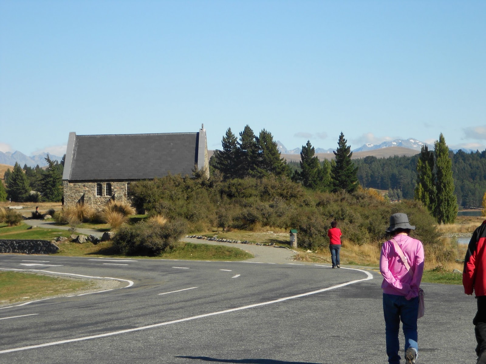 |
| 24.K Church of the Good Shepherd, Lake Tekapo |
 |
| 24.L Bronze Statue of Collie Sheep Dog, Lake Tekapo |
There's more to Christchurch than ruin left by earthquakes. The International Antarctic Centre, within walking distance of the city's airport, is worth a visit. And perhaps some day the city's renewed theatres will also again draw visitors. While much of the central city's high-rise buildings were devastated, one of the city's municipal office buildings survived intact, and therefore (I think) can serve as a memento of Christchurch's hope... along with the numerous, inventive container structures highlighted in a previous blogpost.
 |
| 24.M International Antarctic Centre, Christchurch |
 |
| 24.N In a Simulation Chamber at the International Antarctic Centre |
 |
| 24.O Theatre Undergoing Reconstruction, Christchurch |
 |
| 24.P Municipal Office Building, a Christchurch Survivor |
Wellington's Cable Car Museum rates a shot below. And Wellington's Old St Paul's, I thought, deserved more than the one interior shot I had previously shared.
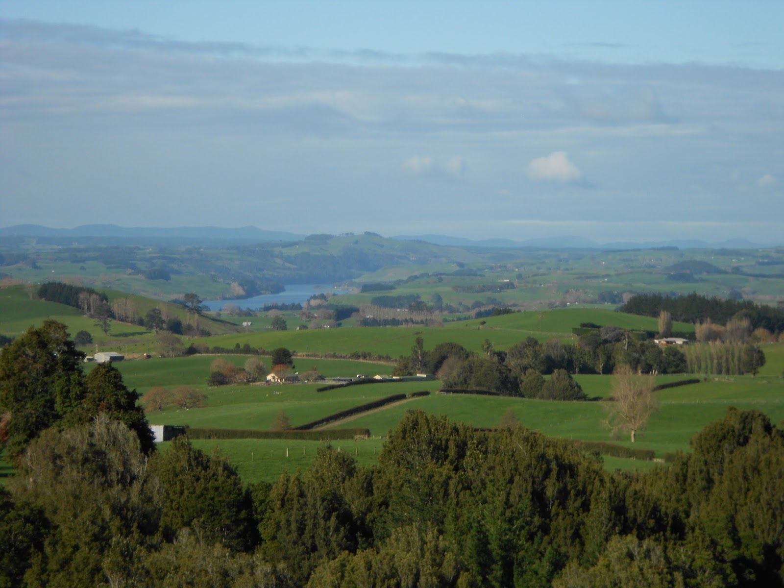
This past Saturday, Jean and I paid our third visit to the Maungatautari Ecological Island Trust park. Herewith below are three photos, including a shot (the last) taken towards the Waikato River from a flank of Mount Maungatautari. It was a beautiful day.
 |
| 24.Q Antique Cable Car, Wellington |
 |
| 24.R Interior, Old St Paul's, Wellington |
During her locum tenens, Jean has served in three towns, two of which I've written about in posts: Te Awamutu (Blogpost 13.05) and Taumarunui (Blogpost 13.09). The third town, Te Kuiti, won't be featured in a blogpost, except for the photo below, showing part of the skatepark built in a corner of the town's former railway yard.
 |
24.S Te Kuiti Skatepark
|
We made a brief foray to the Taranaki Peninsula (on the North Island's Tasman Coast) in late April. We stayed in the city of New Plymouth. Mount Taranaki (also once known as Mount Egmont) and New Plymouth never became the topic of a blogpost. I thought I should at least include a few photos from that foray among the scattershot of this post.
 |
| 24.T Port Taranaki, New Plymouth |
 |
| 24.U Coastal Walkway in New Plymouth |
 |
| 24.V Mount Taranaki / Mount Egmont |
This past Saturday, Jean and I paid our third visit to the Maungatautari Ecological Island Trust park. Herewith below are three photos, including a shot (the last) taken towards the Waikato River from a flank of Mount Maungatautari. It was a beautiful day.
 |
| 24.W Canopy Trees Seen from Observation Platform at Maungatautari Ecological Island |
 |
| 24.X Fern Tree under the Canopy at Maungatautari Ecological Island |
 24.Y Southeastern Vista from Mount Maungatautari
That's enough with the scattershot mementos.
Warm regards,
Tim (& Jean)
|
No comments:
Post a Comment