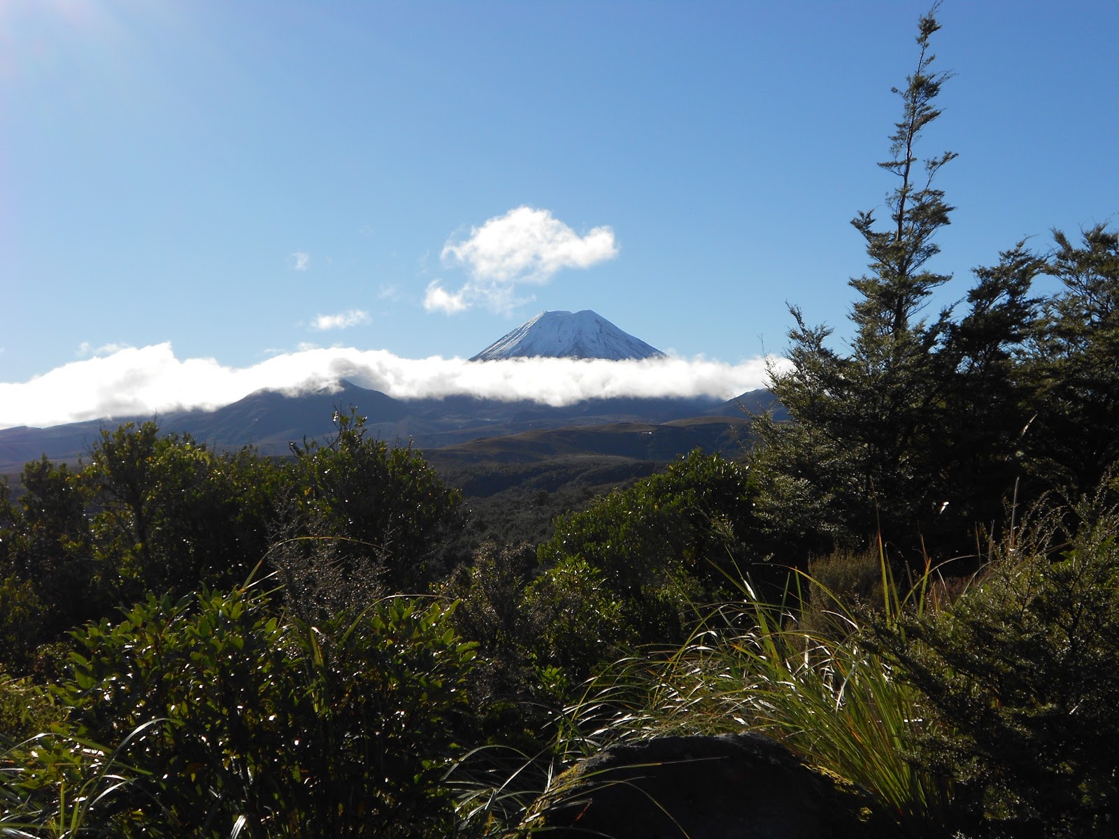
20.A Morning 'Glory' over Mt Ngauruhoe as Seen
from the Chateau Tongariro Hotel
Before
leaving the USA, I came across an article on penguins in Scientific American. From
this article I
learned two things germane to New Zealand, one directly relevant to
the topic of penguins, the other seemingly tangential to the topic.
Firstly,
I learned that the scientific community currently largely subscribes to the notion that penguins first appeared in New Zealand.
Fossil evidence suggests as much. And, although this wasn’t
stated, the fact that New Zealand was naturally ‘friendly’ to flightless birds allowed for the appearance of the birds we call penguins. That
New Zealand was flightless-bird-friendly raises other questions. If New Zealand
was once attached to the supercontinent called Gondwana, what happened to
all the mammals that it inherited from Gondwana, mammals
that would have preyed on flightless birds if the mammals had been around? The
best answer—not necessarily a good answer—is that most of what
we now call New Zealand pretty much eventually sank beneath the waves after splitting off
from Gondwana. That raises additional questions, not least why New Zealand
ever again appeared above the waves. That gets me back to the second idea I learned
from that Scientific American article.
I learned
that what we now call New Zealand and New Caledonia are but
the visible remnants of a so-called ‘submerged continent’ that is
generally called ‘Zealandia’. Zealandia, so Wikipedia informs its readers, is
mostly underwater, ninety-three percent of its area lying beneath the
Pacific. As I described in an earlier post, most of the
South Island is the result of the westward-moving Pacific tectonic plate
overriding the northward-moving Indo-Australian plate. Meanwhile, the North
Island, so pockmarked with active or ancient volcanoes and other evidence of
subterranean ‘heat’, rides above the waves, thanks in part to the Pacific plate diving
under the Indo-Australian tectonic plate. The diving under, you might say,
leads to the Pacific plate being ‘cooked’ so much that it spews out lava, ash,
and steam up above. Or at least that’s my layman’s simple picture of the
complex natural processes that lie beneath what we see in New Zealand.
Last
weekend’s sightseeing had a strong ‘subterranean slant’, if you will. Jean and I
drove over to Cambridge (about 24 km [15 miles] from Te Awamutu), where we caught NZ Route 1, taking it south
through Taupo and Tarangi. Thence we turned onto Route 46 and from 46 onto
Route 47 and from 47 we turned onto Route 48. As easy as counting, we arrived at the Chateau Tongariro Hotel in the Tongariro National Park.
New Zealand has fourteen national parks. Tongariro was the first, having been formed
in 1887 after a Māori chief, Horonuku, conveyed the underlying land to the dominion of New Zealand. He did so with the
understanding that the land was to become the nucleus of a national park. Tongariro National
Park is now designated as a UNESCO World Heritage natural and cultural site.
There are
three prominent peaks in Tongariro National Park, two of which were readily
visible to us from the Chateau Tongariro: Ruapehu and
Ngauruhoe. Weather permitting we eventually saw the park's namesake peak, Tongariro, both from the park periphery and from across Lake Taupo.
After a
night of rain at the hotel’s elevation and snow at higher elevations, the
mountains near the Chateau Tongariro shone in all their beauty and glory. As we retraced our inbound
route, heading outbound and north, we entered a beclouded zone with viewing more varied. Whatever the weather, the landscape was highly various. This is as true of the North Island as it is of the South Island. Up in
the ski village nestled on Mt Ruapehu one is surrounded by an andesitic rubble desert (See Photos 20.G,H,& I). Lower down one
encounters native beech forest (Photo 20.F), as along the stream near the chateau. Elsewhere one encounters 'scrubland' (Photos 20.L & X); I don’t
know what the Kiwis call scrubland. Then there are lands devoted to forest
plantations (Photo 20.M). Beyond that there is mixed forest and farmland with a kind of
Central European look about it (Photo 20.N). And so on and so forth.
There is more than
landscape to account for the recent rise of the New Zealand film industry,
which has produced (among other films) the immensely popular Lord of the Ring ('LOTR') and Narnia series. But the highly varied
New Zealand landscape has given Kiwi filmmakers an advantage in making movies at
home. For example, in the LOTR series some of that Tongariro scrubland served as the 'Plains of Gorgoroth' and Mt Ngauruhoe served as 'Mt Doom'. Back in the real world...
Taupo is on the northeastern shore of Lake Taupo. The lake was made possible
by volcanic eruptions and collapses, the most recent being a massive explosion around 180 AD. The Taupo area is still a subterranean hot zone. Since 1958 electricity has been
generated in the Taupo area from a geothermal generating station at Wairakei (About thirteen percent of New Zealand's delivered electricity stems from geothermal generation). There are a number of fumarole fields in
and around Taupo. You’ll see
photos below (20.Q thru W) from the field we visited, called 'Craters of the Moon'. This field has expanded following the commissioning of the Wairakei generating station.
In a few
more weeks more snow will drape Mt Ruapehu, allowing the ski runs on its
formidable flanks to be opened for the winter. We won’t be joining the ski
crowd. But we can hope to return in some manner and at some time. The Tongariro and Taupo 'hot zones' are fascinating areas of the North Island.
Tim (& Jean)
PS In June 2016 reports surfaced of the discovery of a growing body of magma below the Bay of Plenty town of Matata, which is outside the active Taupo and Tongariro volcanic zones.
PPS Here's a link to the Wikipedia entry on the magnitude 7.8 earthquake that hit the South Island on 14 November 2016.
|


No comments:
Post a Comment