|
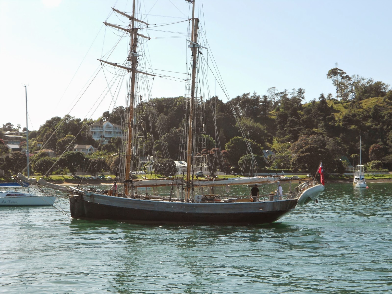
| 1.A Welcome Boxes at Napier Port's West Entrance |
Anyone living in Napier's Ahuriri district can tell you that there's much coming and going in or near the neighborhood. The district's next-door neighbor—to the east—is Napier Port. In descending order of frequency, one sees trucks, trains, and ships entering and leaving the port '24/7', as they say. As in any other human activity, there are rhythms governed by the time and seasons. For example, cruise ships, besides a few outliers, call at the port from late November to early April. More basically, there's probably a preference by ship masters to arrive or depart from the port in daylight, all other things being equal.
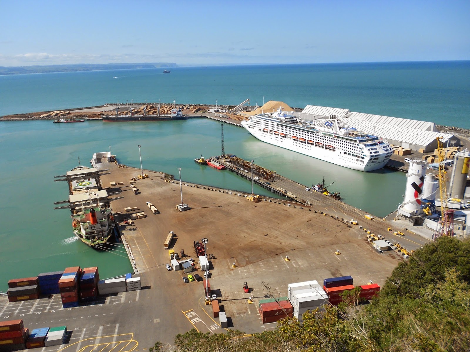
Not that Napier presents difficult navigational passages to and from the high seas. On the contrary, the port is not in a natural harbourage. It's at the foot of a bluff and would be entirely exposed to wind and waves were it not for the breakwater developed following the 1931 Napier earthquake. Before the earthquake, as I understand matters, the townsfolk had been divided over the issue whether to develop harbourage in Ahuriri and the Ahuriri Lagoon or to create the man-made affair that now exists to the east of Ahuriri. The earthquake raised the Ahuriri Lagoon, thereby putting the issue to rest. The photo immediately below provides a view of the eastern part of Napier Port from the Bluff Hill Domain (Kiwis use the term 'domain' for urban parks).
 |
1.C Diagram at the Overlook from Bluff Hill Domain
|
Napier Port bills itself as the 'leading port for central New Zealand'. 'Central New Zealand' is a somewhat ambivalent phrase. The phrase can't refer to either the central North Island or the central South Island. If it did, the claim would be false. Tauranga, among other things, is the leading port for the central North Island, just as Lyttleton—in metro Christchurch—is the leading port (among other things) for the central South Island. Presumably 'central New Zealand' embraces the south end of the North Island and the north end of the South Island. That's at least a geographical argument for locating the country's capital at a place like Wellington, at the south end of the North Island.
But it's not an argument for Napier's being the lead port for central New Zealand. Yet the port is, even displacing in importance the Port of Wellington, at least as determined by the number of containers handled. Container traffic worldwide is measured by a unit called the 'TEU', which equates to a Twenty-foot Equivalent Unit container or box. Each of the two welcome boxes in the lead photo, above, I'm guessing equate to 1/2 TEU. Here below are pictures of TEUs (i.e. 20-foot containers) on a train and 40-foot containers (each equating to 2 TEUs) stacked in the port. Forty-foot containers (standard, insulated, or refrigerated) have become prevalent in international commerce.
 |
1.D 20-Foot Maersk Containers on an Outbound Train
|
 |
1.E 40-Foot Containers Stacked Six High
|
Containerization got underway in the 1960s, impelled by the entrepreneurship of Malcom McLean in the USA and by the logistical needs of the USA in the Vietnamese War (A helpful history of containerization is The Box, by Marc Levinson). When Napier 'containerized', its employment of 'wharfies' dropped from about 550 to about 50, a drop rendered possible by the investment in the requisite container-handling infrastructure. In the early 1970s in New Zealand it was realized that not all of the country's numerous ports would be able to participate in container traffic (as opposed to what is usually called 'bulk traffic' in coal, oil, wheat, timber, etc.). The port infrastructure costs associated with containerization are substantial. In the early 1970s a government commission foresaw that Auckland and Wellington would become the primary container ports for the North Island.
This expectation has proven wrong in several ways. While Auckland has so far maintained its status as New Zealand's No. 1 import port, measured by TEUs, Tauranga is the No. 1 port overall, when measured by TEUs and bulk traffic. Indeed, Tauranga is the No. 1 export port measured by TEUs. And Napier Port has become No. 4 port overall, following Tauranga, Auckland, and Lyttleton. Wellington has little significance in New Zealand's international container traffic.
Tauranga's ascent was in part the product of political and entrepreneurial initiatives arising in Tauranga. In part it was the result of the completion in 1978 of the 8.88-km (5.5-mile) Kaimai Tunnel, cutting three hours from the transit times for freight trains operating between Tauranga and Hamilton, key city in the North Island's dairy-rich Waikato Region and Tauranga's connection to the North Island Main Trunk line. It's entirely possible that Tauranga will eclipse Auckland as the No. 1 import port.
All other things being equal in container transportation, shipping tariffs will favor those points or corridors most balanced in inbound and outbound traffic. If a commodity can be shipped in a box (broadly defined), those who produce or consume that commodity will favor highly balanced ports, railway lines, and trucking corridors because lower rates come with traffic balance. For a port to thrive in the containerization era it must be concerned not only to have technologically advanced infrastructure, it must be concerned with traffic balance.
Because of the voluminous outbound 'box' traffic that Tauranga serves, it's best positioned of all New Zealand's ports to balance inbound and outbound box traffic. Moreover it's not constrained on its land side the way Auckland's Waitemata Harbour is constrained. Meanwhile Auckland and Napier can and do play significant roles in New Zealand's international container traffic.
Napier is playing its TEU cards well, I gather, having captured container traffic that might have otherwise moved, say, through Wellington or Port Taranaki (at New Plymouth). Fonterra, New Zealand's large dairy cooperative, favors Napier Port, for example, for shipments from the dairy-rich Taranaki Region almost surely because maritime shipping lines offer better TEU rates over Napier Port versus over Port Taranaki. Thus, Napier Port is the top container port for 'central New Zealand', at least for right now.
I wouldn't hazard a guess as to how Napier Port will fare, say, 50 years from now in handling TEUs. I will hazard the guess that Tauranga is likely to be the No. 1 export and import port for New Zealand. As container ships become larger (and they're getting larger), New Zealand may have no choice but to allow Tauranga to become the sole international container port for the North Island (and perhaps for all of New Zealand), with Auckland, Napier, and Lyttleton having a secondary or emergency role vis-à-vis Tauranga.
 |
1.F East End of Napier Port's Container Yard
|
 |
1.G Incoming Container Ship with Two Tugs, 8 November 2014
|
 |
1.H Maneuvering the Container Ship to the Container Pier
|
 |
1.I Nudging the Ship to the Container Pier
|
Napier Port is likely to have a continuing role to play in handling bulk traffic. Timber traffic thru Napier Port could become even more substantial than is currently the case if freight service is restored for all or a portion of the Palmerston North - Gisborne Line ('PNGL'), a railway line running 214 km (133 miles) north of Napier. Within the next few years vast, maturing forest plantations in the hinterlands of the North Island's East Coast are to be harvested. The harvesting will inundate the East Coast's limited highway capacity unless relieved by a restored PNGL. Whether Napier Port or other political or commercial interests promote the restoration of the PNGL remains to be seen.
 |
1.J Incoming Log Trucks at Napier Weigh Station along State Route 50
|
 |
1.K A Container & Timber Train Arriving in Ahuriri
 |
1.L Flatcars with Logs Near the Liquid Bulk Terminal at Napier Port
|
|
 |
1.M Vessel at the Timber Loading Pier, 8 November 2014
|
In the meantime, living in Ahuriri affords one the opportunity to see how globalization is made possible by containerization. Boxes can do amazing things.
Happy New Year,
Tim (& Jean)
PPS. Jean and I visited Bluff Hill Domain, overlooking Napier Port, first on 8 November and then again this past Monday, 30 December 2014. On Monday late afternoon there were six ships in the port. Here's some information about the visitors, drawn from Napier Port's website and MarineTraffic.com.
Ship: Flag: Previous Port: Next Port (if known): Cargo
AAL Hong Kong: Marshall Islands: Wellington: Tauranga: General Cargo
Tesoro: Panama: New Plymouth: Tauranga: Logs
 |
| 1.N Spirit of Auckland at Container Pier, 30 December 2014 |
 |
| 1.P Empty Log Flats on the 4:30 PM Outbound |
 |
| 1.Q Containers on the 4:30 PM Outbound |
 |
| 1.R Boxes, Ships, Cranes, and Sky |
 |
1.U MS Voyager of the Seas Leaving Napier Port
|
PPPS. A subsequent blogpost surveys New Zealand road, rail, air, and maritime transport, using speculations about the country's transport futures to (among other things) cast a light on New Zealand's current transport infrastructure.