|
| 21.A Water, Father, Boy on a Toy, All in a Wellington Winter's Day, 3 June 2013 |
Last
weekend was the Queen’s Birthday weekend in New Zealand.
The first Monday in June is observed in New Zealand and Great Britain (among other places) as the Queen’s Birthday. It
is a holiday. Queen Elizabeth II was
crowned on 2 June 1953. So this year happens to include the sixtieth anniversary
of her coronation and the sixtieth occasion for observing her birthday as queen.
Jean and I chose to travel to Wellington this weekend not to
participate in any of the observances. Anyway, there were no obvious observances other
than closed businesses and shortened shopping hours. We simply wanted to see
the capital.
We
weren’t disappointed. We came by train and perhaps in a subsequent post I’ll
expatiate on that journey in New Zealand. But today
I’d like to simply provide a record of our initial impressions of the capital
city.
If
nothing else, Wellington is windy or usually so. Photo 21.B, below, depicts a sign we
saw somewhere in Welly, I believe on Mt Victoria, which is in the city. The windiness is almost
inevitable given the capital’s spot in the world. For one
thing the latitude of the city puts it in the ‘Roaring Forties’, that
belt of bluster that circles the Southern Hemisphere between 40 and 50
degrees latitude south. At this particular latitude only New Zealand, Tasmania, and the far tip of South America obstruct the wind blowing from west to east over the open waters of the seas. Little land impedes the Roaring Forties from being a relentless raceway of wind.
And given
that Wellington is at the far southern end of the North Island, sitting
adjacent to the Cook Strait, which separates North from South, I imagine the
windiness is enhanced by a funneling effect between the islands. On over half the days
annually, average wind speeds will exceed 30 mph, or so we were told.
We stayed
in a hotel, the Kingsgate, where friends had stayed earlier in the year. They
especially commended the location for its being near the national government's executive and legislative buildings.
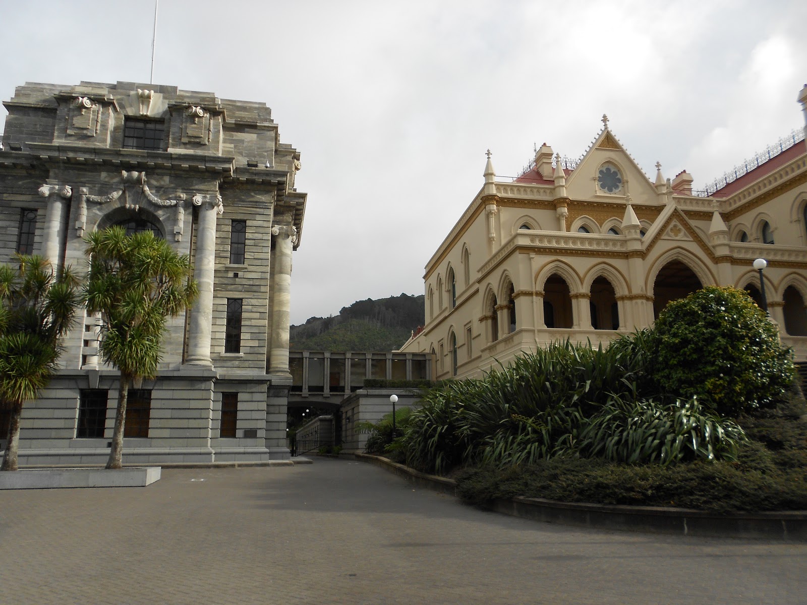
Photos 21C thru E show the main buildings. There are many others. Free tours of the parliamentary complex are on
offer every day, but we didn’t set aside time to take advantage of them.
Ours was a whirlwind stay. We can’t begin to suggest how anyone else might
spend two full days in the capital. But here’s a report of what we did.
We
arrived by train on Saturday shortly before 7 PM and settled into our hotel room after
shopping at the railway station’s great little New World supermarket. The
following morning after breakfast in our room (thanks to the visit to the
supermarket), we headed to church. The previous evening we’d noted that the
Anglican St Paul’s Cathedral was but two blocks from our hotel (As we
subsequently learned, the Catholic cathedral was just a bit further). The
foundation stone for St Paul’s Cathedral was laid by Queen Elizabeth in 1954,
upon her first visit to New Zealand. The cathedral was built in three stages
over the following years, the last stage — the building of the tower — also
being inaugurated by the queen (Photo 21.G). Because of lessons learned from the 1931 Napier earthquake, the cathedral was made of reinforced concrete. The building has a
solid feel about it. The acoustics are good. The organ and its playing were splendid. Alas, no more than twenty percent of the pew seats were occupied. On the
plus side, there were families with kids coming to church on a Sunday morning.
After
church we walked to Old St Paul’s, which no longer serves as the home of a worshiping congregation.
Following the occupation of the first stage of New St Paul’s, the church authorities intended
to sell Old St Paul’s. But there was such a hue and cry, Old St
Paul’s was preserved. The land is now owned by the national government. The New Zealand Historic Places Trust is charged with maintaining the structure and keeping it open to the public. Old St Paul's is a wooden structure (Photo 20.I). Wood
was chosen over brick because the founders considered wood safer than
brick in the event of earthquakes. Wellington is built in an area of active faults.
Kiwis thought the next ‘Big One’ would hit Wellington, but as we all know the
Big One hit where least expected — in Christchurch (See post 13.13). While the wooden
church has endured, it had to be expanded laterally in its very early years
to secure the structure against the buffeting of Wellington’s winds.
Besides
wedding services conducted at Old St Paul’s when the premises are hired, Old St
Paul’s hosts one annual service on the Sunday of the US Memorial Day weekend. A
force of 20,000+ Marines was stationed in New Zealand during World War 2 to the
common advantage of New Zealand (whose young men were serving in North Africa
and the likes) and the USA (which needed a strategic foothold in the Southwest
Pacific). The wreaths placed in Old St Paul’s are tokens of the remembrance and gratitude that Kiwis give for the presence of the Marines during the war (Photo 21.J).
After a
Sunday lunch at a pub in downtown Welly we took advantage of the cable car
service up to the city’s botanical gardens. The Wellington Cable Car has been running
since 1902. It’s the most elaborate of the city's cable railways, with three tunnels and three bridges (which can be viewed in this YouTube video).
But it’s not alone. There are over 400 cable railways in the city, most rather
modest single-rail affairs leading up to homes that would otherwise be
inaccessible. Wellington, like San Francisco (its sister city), is very hilly. But then much of New Zealand, especially the North Island, is hilly where it's not outright mountainous.
Before
Sunday was over Jean and I attended a production of Midnight in Moscow, a play by Dean Parker, set in
1947 at New Zealand’s Moscow legation. The play and production were very
good. The play is about friendship and loyalty and misplaced dreams. Midnight in Moscow was performed at the Circa Theatre, which is a small neighbor of
the huge Te Papa Tongarewa, New Zealand’s national museum. We visited Te Papa the next
day, on Monday.
But first
on Monday we took an excellent guided bus tour of Wellington. We caught it near
the building where Wellington’s i-Site (or information center) is housed. Photo
21.N captures that building. I include the photo not for its architectural interest
(if any) but because it illustrates the winter fate of native southern beech
trees on the left and imported deciduous trees, which defoliate in winter. The New Zealand landscape is green year around (droughts aside), except where exotic species
have been introduced. Why bring in the exotics? That's a question for another day, but not here.
I won’t
give a running account of the tour. I have included a number of cityscape
pictures. From its very beginning Wellington reserved land to be kept as
‘bush’, covered with native plant life. So amidst all the housing, schools,
offices, shops, and so forth you’ll find broad stretches of green. The town’s
harbor, which used to be adjacent to the central business district ('CBD'), was re-established at a container
yard (Photo 21.U), thereby allowing the CBD waterfront to be redeveloped. Old customs houses
and cargo sheds have become venues for museums, restaurants, and shops. Open
areas have been developed into ‘squares’. And all this has been populated with
sculpture, kid-friendly playgrounds, much of it touched with whimsy, even a
pair of public toilets made to look like lobster tails.
In
touring about we were taken to a section of Wellington now known as
‘Wellywood’. Wellywood is just past the city airport (Photo 21.R). The airport is about 300 meters
shy of being able to handle the really long-distance international flights. That's one reason all such flights operate in and of Auckland. Just south
of the airport one encounters a Hollywood-like sign that ought to read
‘Wellywood’, not ‘Wellington’ (Photo 21.S). For south of the airport is the so-named district now drawing,
reportedly, 4000 workers involved in New Zealand’s film industry. That industry
has rightly become a source of pride as well as income.
After
lunch at an Italian place on the waterfront, we visited the New Zealand Portrait Gallery (in an old warehouse). Then we visited the Wellington City & Sea Museum, which provides splendid insight into the history of this city
on the sea. And finally we visited Te Papa. We only saw a small portion of Te Papa. All these museums provide free admission, which is generally
customary in New Zealand. Only the Andy Warhol special exhibit at Te Papa
required paid admission (NZ$17.50 per adult). Te Papa could
be visited many times without exhausting its treasures. Of the three we
visited, my favorite was the City & Sea Museum.
Somewhere
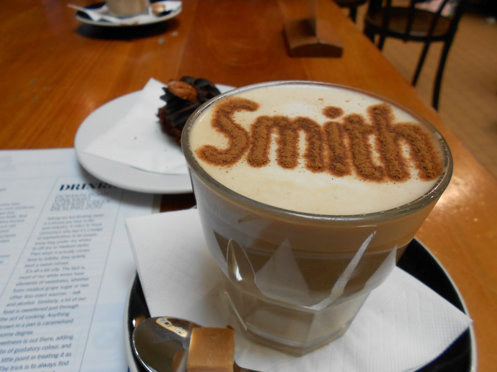
near the street depicted in Photo 21.Y we visited Smith the Grocer Café, where both Jean
and I ordered chai lattés. Not only were the lattés delicious but the barista
knew how to spell… in cinnamon. With that this brief excursion to Wellington is over. We flew back north Tuesday morning and hope to return some day.
Warm
regards,
Tim
(& Jean)
PS. A subsequent visit to Wellington, in 2015, is reported in this blogpost.
 |
| 21.B Sign on Mt Victoria? Definitely in Wellington. |
 |
| 21.C The Beehive and the Parliament House |
 |
| 21.D 'Bush' Viewable between Parliament House & Parliamentary Library |
 |
| 12.E Parliamentary Library |
 |
| 21.F Entrance to St Paul's Anglican Cathedral |
 |
| 21.G Dedication Stone for St Paul's Tower |
 |
| 21.H Interior Following Church Service |
 |
| 21.I Old St Paul's, 2 June 2013 |
 |
| 21.J Floral Tributes to the US Marines, Old St Paul's |
 |
| 21.K Cable Car Arriving at Station under Reconstruction |
 |
| 21.L Interior of Wellington Cable Car |
 |
| 21.M View from Botanical Gardens |
 |
| 21.N Wakefield St, Wellington |
 |
| 21.O View of Lambton Harbor, Wellington, from Mt Victoria |
 |
| 21.P Wellington's CBD |
 |
| 21.Q Posh Residential District |
 |
| 21.R Wellington Airport |
 |
| 21.S Wellington Sign (South of the Airport) |
 |
| 21.T Looking over a Residential District towards the Tasman Sea |
 |
| 21.U Wellington Container Port |
 |
| 21.V Playground Equipment along the Waterfront |
 |
| 21.W Men's & Women's Public Toilets near the Waterfront |
 |
| 21.X Public Art near Municipal Buildings close to the Waterfront |
 |
| 21.Y Wellington CBD Scene |
 |
| 21.Z Chai Latté at Smith the Grocer Café, Wellington |